The Arctic has a special effect on global weather, commerce, and security. The ability to collect data in this rapidly changing region has become a key enabling capability for research, forecasting, and regional and national planning. Atmospheric measurements collect data for predicting the weather, monitoring severe weather, and improving climate models. Environmental data collected from the region is important to those nearby as well as policy and security decision makers. However, collecting measurements in the Arctic has historically been challenging.
What We Do
Sandia collects more precise weather, environmental, and climate data with help from a variety of tools, technologies, and one-of-a-kind facilities. The extreme conditions and remoteness in the Arctic allow Sandia to develop, test, validate, and improve data-collection technologies for other national security uses.
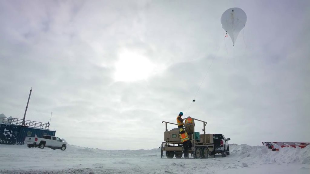
Using tethered balloons and drones, Sandia collects data related to atmospheric thermodynamics, cloud microphysics, and aerosol properties critical for weather forecasts, monitoring severe weather, and improving atmospheric models. Sandia also works with radar (such as synthetic aperture radar) and lidar (such as Raman lidar) systems, including hardware, software, algorithms, and data analysis, for the remote sensing of sea and land ice. Sandia completed the first continuous, long-term monitoring field campaign involving measurements of methane, black carbon, and other greenhouse gases at Utqiagvik, Alaska.
Sandia offers unique instrumentation for harsh, remote, and extreme conditions. In addition to expanding Atmospheric Radiation Monitoring (ARM) program site measurement and monitoring capabilities, we have installed and monitored other institutions’ instrumentation.
We work with innovative tools, technologies, and facilities to collect never-before-available data:
- Drones, aka unmanned aerial systems (UASs), provide reusable, lower-preparation means to collect from more remote locations, more frequently, at various altitudes.
- Tethered weather balloons carry distributed temperature sensors to collect Arctic atmospheric temperature profiles, among other sensors, such as supercooled water sensors which can measure multiphase clouds.
- ARM facilities enable uniquely located data collection and Arctic climate measurements.
- Access to 700-mile-long restricted airspace over the Beaufort Sea at Oliktok Point enables Sandia to conduct experiments and exercises over Arctic waters without risk to human-piloted aircraft.
- Advanced sensors, such as Raman lidars.
The Arctic requires specialized operational and sensing equipment. Sandia’s experience measuring harsh, inaccessible environments enables Sandia to collect data identified by sponsors and stakeholders as critical to understanding key Arctic systems. For example, Arctic research and data can inform Coast Guard, commercial, and military operations, allowing them to operate more safely and effectively.
Understanding Arctic Systems

Launching a tethered balloon in the Arctic:

With our modeling capabilities, expert staff, and focus on Arctic science and security, Sandia can assist partners in taking and collecting measurements as well as analyzing and applying the data.